río Guatiquía
Country
Colombia
Region
Meta
Length
137 km
General direction
SE 119.99°
Starts near
Cerro Peña De Las Ciervas
˜[ 4.606,-73.803 ]
Tributaries
(Without claiming to be exhaustive):
(Without claiming to be exhaustive):
Sorting
up/down
up/down
Flows in
Fishes of río Guatiquía
(Without claiming to be exhaustive)
(Without claiming to be exhaustive)
Species
Country
Origin
Country
Origin
Length
(cm)
(cm)
AQ
(cm)
(cm)
T.
(°C)
(°C)
Bree
ding
ding
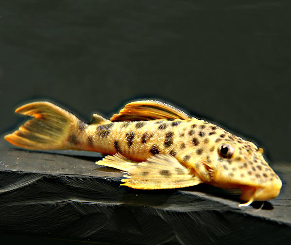
Chaetostoma formosae (L 444)
Ballen, 2011
Colombia
quebrada Piedras Negras, caño Mateguadua, caño Chichimene, río Orotoy, río Acacías, río Guayuriba, quebrada La Candelaria, quebrada Cuyandera, río Caney, caño Caibe, río Camoa, río Guejar, río Ocoa, caño La Curia, caño Quenane, quebrada Guamal, río Ariari, río Guatiquía-Einzug
(Boyacá, Meta, Casanare)
")
13
100
23 - 27
yes

8
60
unknown
2 entries found.
Many thanks to
for the pictures
aneroeancoh
1
Please help with your pictures and information to complete the database: database(at)welsfans.de
