córrego do Chapéu / ribeirão Água Preta
córrego do Chapéu / ribeirão Água Preta → rio Cristalino (⪪) → rio Araguaia (⪪) → rio Tocantins (⪪) → rio Pará (⪪) → baia de Marajó (⪪) → Atlantic NE (⪪)
Country
Brazil
Region
Mato Grosso
General direction
NE 32.47°
Starts near
[ -14.425,-51.636 ]
Flows in
Fishes of córrego do Chapéu / ribeirão Água Preta
(Without claiming to be exhaustive)
(Without claiming to be exhaustive)
Species
Country
Origin
Country
Origin
Length
(cm)
(cm)
AQ
(cm)
(cm)
T.
(°C)
(°C)
Bree
ding
ding
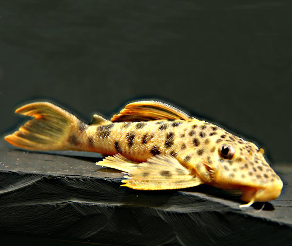
Rhinotocinclus cf. longirostris "rio Agua Preta"
Brazil
rio Agua Preta = córrego do Chapéu
(Mato Grosso)
Brazil
rio Agua Preta = córrego do Chapéu
(Mato Grosso)
3
60
26 - 29
unknown
One entry found.
Please help with your pictures and information to complete the database: database(at)welsfans.de
