río Ranchería
Country
Colombia
Region
La Guajira
Length
260 km
Tributaries
(Without claiming to be exhaustive):
(Without claiming to be exhaustive):
Sorting
up/down
up/down
Flows in


Fishes of río Ranchería
(Without claiming to be exhaustive)
(Without claiming to be exhaustive)
Species
Country
Origin
Country
Origin
Length
(cm)
(cm)
AQ
(cm)
(cm)
T.
(°C)
(°C)
Bree
ding
ding
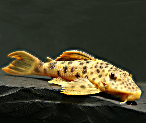
Cordylancistrus tayrona
Provenzano, Milani & Ardila, 2017
Colombia
Sierra Nevada de Santa Marta, Sierra de Perijá, quebrada El Congo, río Hurtado, río Badillo bei Valledupar, río Guatapurí, río Pontón, río Ranchería, río Seco, río Sororia = arroyo Santa Cruz, unbekannter Zufluss zu arroyo Tauayo, río Tocaimo, río Tucuy
(Cesar, Magdalena, La Guajira)
13
80
18 - 24
unknown
13
80
unknown
Rineloricaria giua
Castellanos-Mejía, Londoño-Burbano, Ochoa, García-Alzate & DoNascimiento, 2024
Colombia
río Tucuy, río Badillo, río Aracataca, río Frio, río Carare, río Ranchería
(Cesar, Santander, La Guajira)
Castellanos-Mejía, Londoño-Burbano, Ochoa, García-Alzate & DoNascimiento, 2024
Colombia
río Tucuy, río Badillo, río Aracataca, río Frio, río Carare, río Ranchería
(Cesar, Santander, La Guajira)
13
unknown
Sturisomatichthys aureus
Sturisoma aureum
Steindachner, 1900
Colombia
río Sororia = arroyo Santa Cruz bei Jagua de Ibiricó, canal San Silvestre, río Tucuy, río Samaná, ➀ río Magdalena, río Baudó, río Cerrejoncito, rio El Jagual, arroyo Hondo, arroyo La Quebrada, quebrada La Raya, río Ranchería, río Simaña, río San Jorge- , río Cesar-Einzug
(Bolívar (COL), Boyoacá, Antioquia, Córdoba, Cesar)

23
150
25 - 28
yes
4 entries found.
Many thanks to
for the pictures
Válvula Howell Bunger (CC BY-SA 4.0)
1
HalvisC (CC BY 3.0)
2
Carlos A. Revelo Ris… (CC BY-SA 3.0)
3
Armin Ackermann
4
Please help with your pictures and information to complete the database: database(at)welsfans.de
